


Regional Information
The Goldfields Esperance region is the largest in WA measuring 955,276 square kilometres and accounts for a third of the total land mass of WA and over three times that of the State of Victoria.
The Goldfields Esperance region is situated in the south-eastern corner of Western Australia (WA) and incorporates ten local government areas:
| Shire of Coolgardie www.coolgardie.wa.gov.au Shire of Dundas www.dundas.wa.gov.au Shire of Esperance www.esperance.wa.gov.au City of Kalgoorlie-Boulder www.ckb.wa.gov.au Shire of Laverton www.laverton.wa.gov.au Shire of Leonora www.leonora.wa.gov.au Shire of Menzies www.menzies.wa.gov.au Shire of Ngaanyatjarraku www.ngaanyatjarraku.wa.gov.au Shire of Ravensthorpe www.ravensthorpe.wa.gov.au Shire of Wiluna www.wiluna.wa.gov.au | 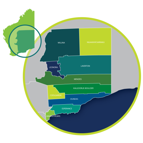 |
Follow Us: